The Tyne Tour is one of the best kayak/canoe events in the UK. Since its origins as the Mike Jones Rally the Tyne tour has become a firm favourite of mine. Most paddlers will stick to the area around Hexham and Tyne Green but there are several other stretches of water in the local area that are worth looking at. This post is not designed to be a definitive guide in any way but is intend to offer a few ideas so you can maximise your paddle time and choice if attending the tour. So here we have it The Tyne Tour – A Brief Water Guide.
Camping, food and retailers are all based at Tyne Green right on the river bank in Hexham. Hexham is large market town so there are plenty of shops, pubs and takeaways if required.
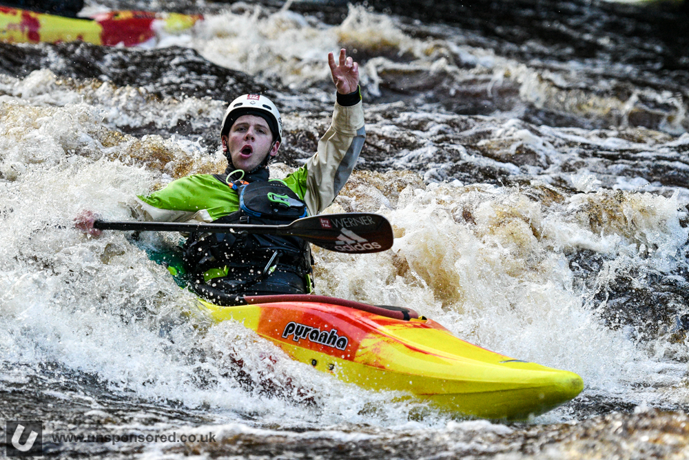
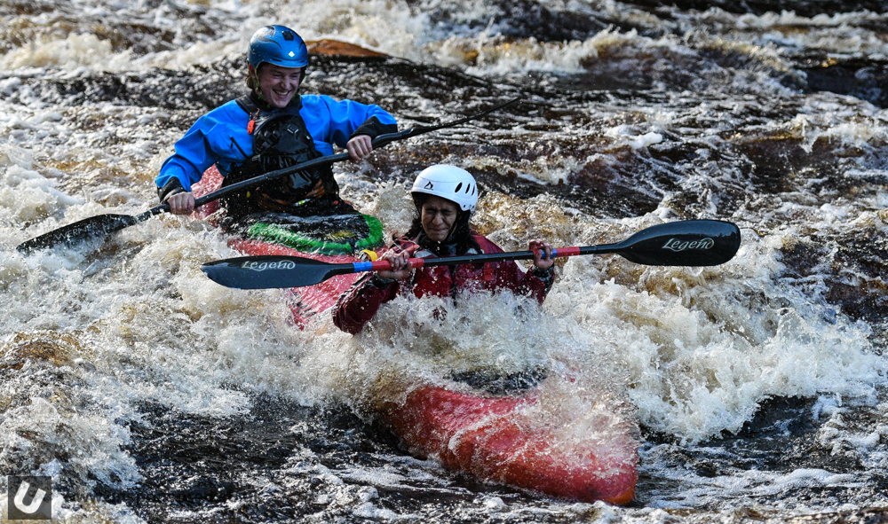
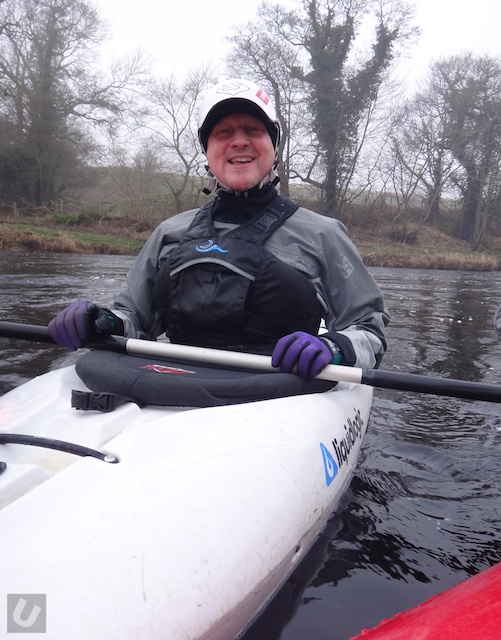
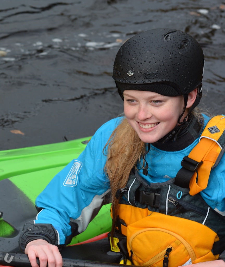
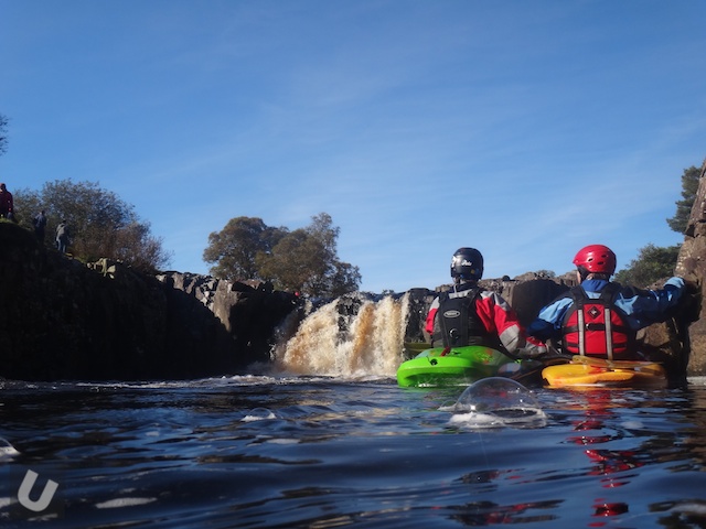
The main river for the tour is the North Tyne. Local canoe/kayak clubs provide safety cover on the largest whitewater section of the North Tyne at Rescue Rock. Each Saturday of the Tyne Tour you will find me sat on Rescue Rock taking thousands of still images.
River Levels: Rain Chasers
The North Tyne
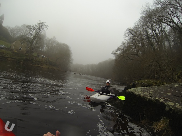
The North Tyne has to be one of the classic ww runs in the North East of England. The water is clean, access is pretty good and you can get down in all but the very lowest of levels. The normal get in is at the small village of Chollerford just a few miles North of Hexham itself. However for the Tyne Tour the get in is a few miles upstream at Barrasford. A shuttle bus runs the route and the parking at Barrasford is ample. The run down to Chollerford offers a few good rapids and is the perfect warm up.
The North Tyne is a great introduction to grade II/III water. For the freestyle paddle a number of decent play opportunities do exist along the North Tyne’s length. The paddle down from Chollerford can be quite interesting with a number of places to stop and play along the way. Releases from Kielder Dam are quite frequent through the winter months which means that at high levels the whole river becomes a play park of grade III/IV. The weekend of the Tyne Tour coincides with one of these releases.
The 1st few miles is a comfortable grade II with Roman fortifications and plenty of wildlife lining the way. All the rapids are easily negotiated and playspots found along the entire run. Very few long flat sections exist so its not to much of a long slog in short play boats.
The river spices up a little as you reach the “Chicken Shoot” which signals the approach of Wardens Gorge.
The river splits at this point and is funneled (river right) down a short mill race, and river left down a rocky rapid. The area in between holds a small fall that can be shot in the centre.
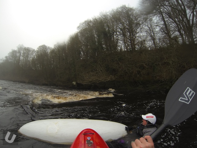
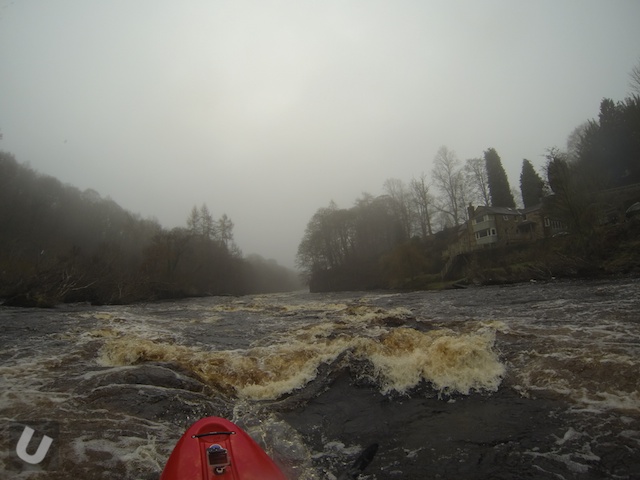
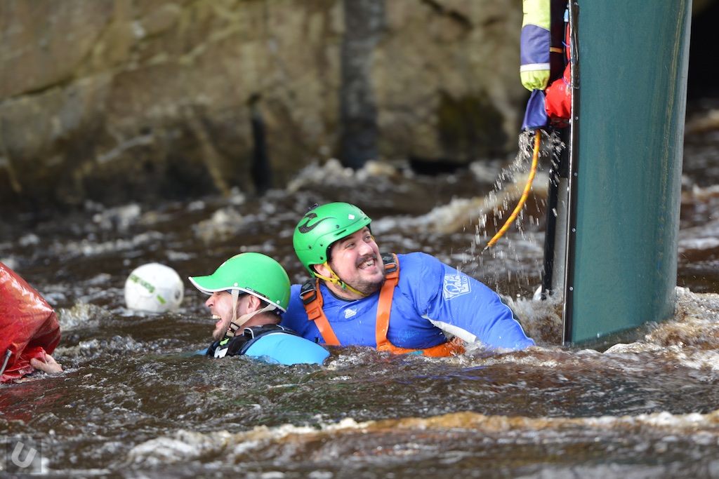
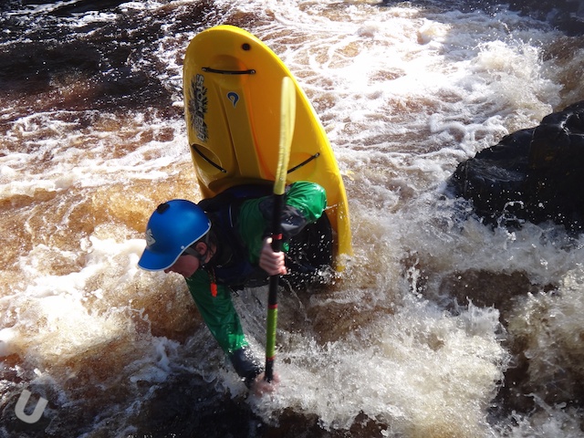
The next rapid is Wardens Gorge. This rapid offers the greatest diversity. The gorge has gained quite a reputation from paddlers on the “Tyne Tour”, but is really a straight forward rapid with plenty of eddies on the way down. The land river right is privately owned and should not be used for inspection. During the Tyne Tour inspection and portaging either side of the gorge is not allowed.
For spectators the gorge can be accessed via short walk in from the confluence of the two Tynes near the village of Acomb. Viewing space at the bottom of the gorge at rescue rock is limited. If the water is very high there will be very little rock available for spectators to watch from.
At extreme levels the lower part of the gorge is dominated by a large wave/hole. I have ran the N Tyne at this level a number of times. It is possible to avoid the stopper but it is tight. If you miss the line (extreme river left) then you will be in for a kicking. Use your own judgment, if the water is well up into the trees and there is a transit van size stopper – go to the pub. At low to medium levels a really nice/tame wave is formed.
After the gorge a series of small rapids with obvious lines and then flatwater leads you down to the confluence of the Tynes. Here the river is wide and deep before narrowing and flowing under the A69 road bridge and on to Hexham/Tyne Green.
The South Tyne
The usual run on the South Tyne starts at Haydon bridge and runs down to the confluence (grade II) with the North Tyne near Acomb. However much more challenging water can be found further up stream towards and beyond the market town of Alston (Tynedale – Garrigill III/IV, Garrigill – Alston II/III, Alston – Haydon Bridge II/III).
The Allen
This is my favourite river in the North East. The Allen offers almost uninterrupted white water (III/IV) from the get in point at Cupola Bridge down to Planky Mill. The one rapid to watch out for is the natural sloping weir (Hag Fall) which can have a nasty stopper and tow back in very high water. Eddy service above the fall is sparse but portaging/inspecting the fall is possible from river right as a good quality footpath runs the full length of the river. For the most part the footpath stays pretty close to the water.
Devils Water
Devils water is a narrow piece of water that flows into the Tyne just up stream of Corbridge. It can make a good quick run in medium to high water with plenty of small rapids along the way. A big horseshoe shaped weir is the only real danger. Devils water is pretty narrow and can suffer from tree fall.
Venture a little further south and you hit the Tees with a number of different stretches of water to tackle. Numerous sections of the Tees are worth having a look at. Here are some of the highlights:
River Tees – High Force to Low Force
This has to be one on the classic all year runs in the UK. This section may be short but can be ran at most times times of the year.
The get in is at the High Force Hotel where there is ample parking. A small fee will get you parking and access to the water. The river can be reached by walking a few yards east from the hotel where a footpath leads you down the valley to a large grassed area some two hundred yards down stream of high force itself.

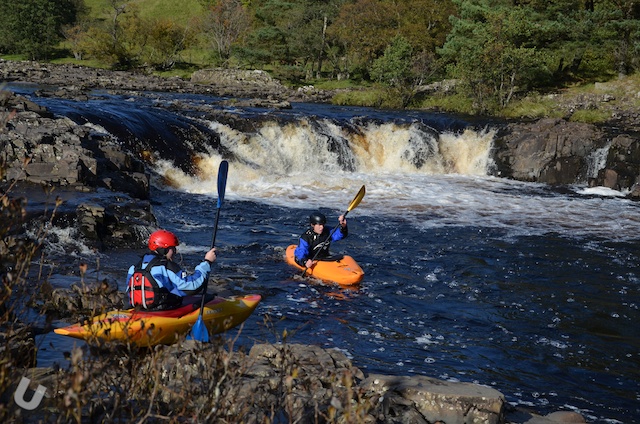
From here the river bimbles down through some grade II/III rapids before reaching Salmon Leap (aka Dog Leg) falls. In each case the line is easy to work out. If needed a path runs down the whole length of the run (river right) which is great for inspection or another sneaky go of the last rapid!

Salmon Leap often causes a few problems. If you are unfamiliar with Salmon Leap inspection/rescue cover can be done river left or right (as shown in the image). A small eddy can be found just upstream of the rapid on the river left.
The correct line is easy to spot. For larger groups it is also possible to land river right.

A succession of smaller rapids/falls leads you onto Low Force, which is infact a two stage fall.
The first stage is a horseshoe fall and looks deceptively easy but holds a potentially nasty stopper. At medium to high levels the water runs over rocks river right, at this level the fall is best avoid by either portaging or running over the rock far river right.

Quite a few paddlers have been recirculated here in medium to high water levels – you have been warned. It is very difficult to either paddle or swim out of.

Just below this first stage the river forms a bowel and splits to flow over the largest 2nd fall.


Your best bet at all water levels is river right. The line is uncomplicated and the drop pool deep. The only danger at medium to high levels is being pushed towards the rock wall river right.

Running the falls river left has been done but is both complex and dangerous unless the water is at the right level. At the right level the line is very straight forward.

The pool also provides easy rescue if needed, either from boat or the bank. Just after the fall lies Wynch bridge (one of the oldest if not the oldest metal suspension bridges in the world) below here is a small angled rapid followed by flat water and grade II rapids until you reach the village of Middleton. Unless in medium to high water this stretch doesn’t hold much interest.
You can land one either bank above Wynch bridge and head north back to the main road. On the road is a small village (Bowlees) and a lay by capable of accepting a few cars. It is also only a mile or so back to the hotel if you are feeling fit!
River Tees – Racing Stretch
The stretch of the Tees from Egglestone to Cotherstone is known as the racing stretch due to its use as a ww racing venue. Access at Eggleston Bridge has been dodgy for some years so you are better off heading up stream to put on at Middleton. The outdoor centre at Middleton is a pefect place to get on it can found just outside of town on the road to High Force. As you leave town you’ll go over a stone bridge which has a tight left hand turn. As you head up the bank you’ll see some new houses on the left. the outdoor centre lies just beyond the houses. Don’t park in front of the house, just call into the outdoor centre and ask to leave your car. 9 times out of 10 it will be OK. A short 200m walk down a narrow footpath takes you right down to the river. Alternatively park in town and walk down to the river.
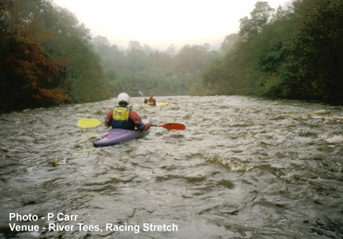
The first stretch down to the start of the racing stretch is a grade II/III with easy lines. From Egglestone bridge the water is pushed right and the river narrows (grade II). This is the 1st of many rapids on the stretch. Plenty of waves, and a few holes can be found on this stretch leading down to Cotherstone. Rapids are even spread with the majority being fairly long and of grade III. At times the river can feel dark and remote as the river walls and tree lined bank rise above you. Meeting fishermen and other paddlers is rare.
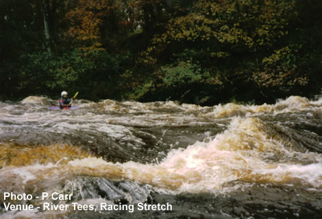
Lines are obvious throughout and inspection possible in most cases. At high water levels the river is extremely fast and eddies are few and far between. Many of the rapids become big and bouncy and all stoppers can be escaped with ease.
As you approach Cotherstone you’ll pass a green iron footbridge just before the River Balder comes in from the right. Beyond this get out at a beach river right. Follow the track to the playing fields (where cars can be left) or carry up the steep bank, back to the main part of the village.
Below Cotherstone the river flattens out. At high levels its worth a run since it requires little effort. However the man made weir at Barnard Castle is a killer, the towback is fierce! The weir has an anti scouring construction and has resulted in one paddler loosing an ear. He was lucky to pulled out alive. Portage can be made river left.
UPDATE: The EA have reconstructed the weir at Barnard Castle. I have not paddled this lower section since the rebuild.
River Tees – Barnard Castle to Whorlton Lido/Winston
This is a great section of the Tees, with lots of variety on offer. The initial run from Barnard Castle offers a great warm up for Abbey Rapids. This is the site of the old Eggleston Abbey and a section of the river that narrows quite considerably through a gorge and under the stone Abbey bridge. This area is used as a slalom training site and as such can have poles/wires across the river at times. At high water the river is pushed at a massive rate through this section providing some big stoppers and standing waves.
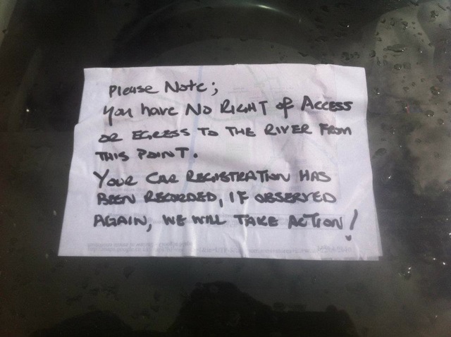
From the Abbey onwards the river provides numerous small rapids until you hit Whorlton Lido. Just below the road suspension bridge is a natural weir. This weir can have a nasty tow back and I have rescued my Dad from the tow back a number of years ago. You can get out here river right just below the falls and some limited parking can be found on the south side of the bridge. There have been some issues in the past with cars being vandalised so be warned.
Downstream from the Lido is a number of natural rock weirs and shelves that provide standing waves and stoppers of various sizes. Winston is the next natural egress. Below Winston has little to offer the WW paddler. Again Winston has its issues with parking.
River Greta
This trib of the Tees is superb run but not really suitable for larger groups. Lots of good length rapids (III/IV) and the potential of fallen trees makes this an interesting run. The Greta flows into the Tees just above Whorlton Lido making the Lido or Winston the perfect get out point.
There are several other runs around the North East that are well worth checking out depending on how far you wish to travel from Hexham and the Tyne.
You could also include – The Swale, Tees Barrage, the Northern Lake District and Tynemouth beach for some quality surf as part of your time at the Tour.
I would high recommend getting hold of a copy of the English Whitewater or even the much older Canoeists Guide to the North East.


")


")


One to add: the Irthing. If there is rain it is well worth getting on. Mostly continuous class three, best in high water. One class 5 waterfall at the put on. It’s only 30 mins from Hexham. I’ve got a couple of pictures if you want.
Some pics would be great.